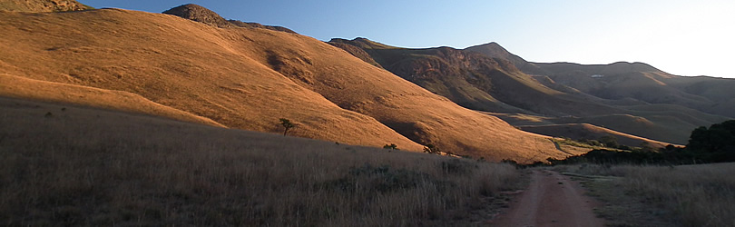
This consolidated approximately 18 000 ha of State, community-owned and privately held land into a single reserve. The model holds all the elements of a true Community, Public, Private Sector Partnership and on this large scale is a pioneering concept for conservation in South Africa.
One of the principal strengths of the reserve is the increased ecological and economic viability achieved through the consolidation of the different properties into a single entity. At the same time, one of the principal challenges was the requirement to integrate different aims, priorities and philosophies held by the respective owners into a single management and financial model.

Thus, once agreement was reached about the land to be included and institutional arrangements were in place, an integrated development plan was compiled for the development of the reserve. The integrated development plan, reserve management plans and individual facility development plans are aligned to guide all aspects of development, reserve establishment and management functions through an adaptive management approach. All of these mechanisms are designed to fulfill the vision and objectives of the reserve through a set of Guiding Principles.
The vision is to ensure financially sustainable conservation of the Mountainlands Nature Reserve through cooperation for the benefit of Members, stakeholders and the public at large.
The objectives for the Mountainlands Nature Reserve are :
- To create a single, viable nature reserve with associated wildlife;
- To conserve its rich biodiversity and geological heritage and maintain (or where required restore) ecological functions and processes;
- To strive towards financial independence of the reserve through income generation that is based on certain common assets;
- To benefit Founding Members and stakeholders through responsible and sustainable resource utilization and development.
The following guiding principles underlie the association of Members :
- Managing the reserve according to acceptable conservation and business principles, based on sustainable resource utilization and development;
- Following a cooperative management approach;
- Ensuring that the development of the reserve capitalizes from and contributes to the regional economic development through synergistic approaches;
- Entrenching individual land owner’s rights to tourism development subject to agreed principles;
- Supporting beneficiation, socio-economic upliftment and training of involved communities;
- Making suitable designated portions of the reserve accessible to the public on a controlled and paid for basis.
INTEGRATED MANAGEMENT PLAN
The core of the Integrated Management Plan revolves around the zonation of the reserve and identifying environmentally sustainable developments based on their scale, location and possible impacts. These development opportunities are currently being explored and interested parties are invited to make contact. Only the Mountainlands Estate development with its 18 private stands has been completed.
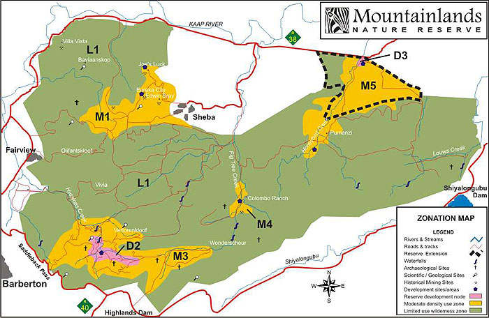
Above map indicates the zonation of Mountainlands and refers to the following categories of developments that were identified in 2005:
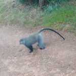
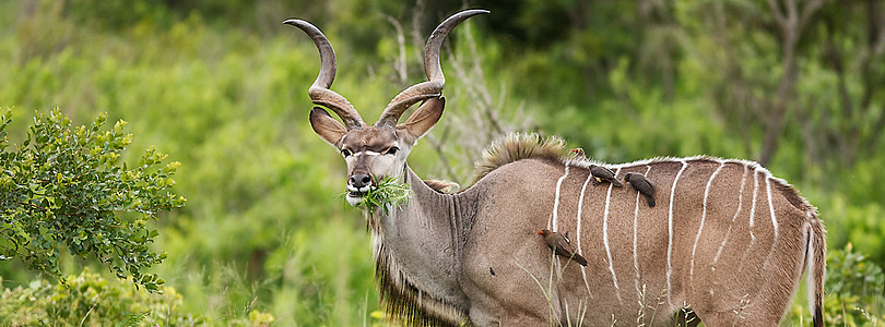
- Specialist interpretive day trips and overnight tours based on geology, archaeology, history, birding, game, small mammals, plants and butterflies.
- Core tourism developments inside the reserve.
The zonation and sheer size of the reserve minimizes the impact of the different facilities on each other. For example, the likelihood of game viewers from the different facilities encroaching on each other during game drives is very remote. Privacy is further ensured by classifying access roads to development sites as private roads for the exclusive use of the owners or guests of a particular site.
Integrated Management Plan – 2014 Review
Nature reserve management plans are dynamic and are typically reviewed every few years. The review of the Integrated Management Plan (IMP) was completed in 2014.
In order to effectively allocate management actions to each individual phase, the Integrated Management Plan (IMP) has been separated into five volumes as follows, in PDF format:
Volume 1: Overarching IMP Document (2.9 Mb):
Including overall management objectives and action projects which are common to all three phases of the Barberton Nature Reserve. The IMP includes an Integrated Zoning and Tourism Master Plan which forms a separate volume;
Volume 2: Integrated Zoning and Tourism Master Plan (6.7 Mb):
Includes zoning and tourism development opportunities
Volume 3: Phase Specific Document, Phase 1 (1.7 Mb):
Including management objectives and action projects which are specific to Phase 1
Volume 4: Phase Specific Document, Phase 2 (1.6 Mb):
Including management objectives and action projects which are specific to Phase 2 (3 Areas)
Volume 5: Phase Specific Document, Mountainlands Nature Reserve, Phase 3 (2.5 Mb):
Including management objectives and action projects which are specific to Phase 3 (Mountainlands Nature Reserve)
Download the high resolution Maps (55 Mb) and Plans (36 Mb) which appear in the above volumes (ZIP files). Included in these packs are the following:
Map 1: Topography / Shade Relief
Map 2: Satellite Image
Map 3: Conservation Planning
Map 4: Geology
Map 5: Land Cover / Land use patterns
Map 6: Soil Patterns
Map 7: Terrain Description
Map 8: Vegetation
Map 9: Slope Analyses
Map 10: Zones of Visual Influence
Map 11: Viewshed Protection Zone
Map 12: Environmental Sensitivity Index
Map 13: Environmental Sensitivity Classes
Map 14: Land Use Zoning
Map 15: Land Use Zoning and Special Management Overlays
Plan 1: Study Area
Plan 2: Regional Attractions and Amenities
Plan 3: Local Attractions
Plan 4: Access
Plan 5: Local Amenities
Plan 6: Concept Development Plan
Plan 7: Tourism Master Plan
Plan 8: Expansion and Linkages
INTERPRETIVE TOURS
Specialist interpretive day trips are based on Geology, Archaeology, History, Birding, Game and small mammals, Plants and Butterflies as well as other areas of specialization. These tours are contracted only on carefully determined fixed routes to ensure that they do not impact on other facilities and owners in the reserve.

The following components form part of the products being developed for specified zones of the reserve:
- Guided 4×4 traversing of low density zone based on operation by specialist operator on concession basis. Control and income could be enhanced by placing this out on concession.
- Guided overnight wilderness hikes or horse safaris with strong educational/interpretive slant utilising two small fly-camps based on operation by specialist operators on concession basis.
- Eureka city & Edwin Bray area. Visits to the Edwin Bray shaft (Golden Quarry) of Sheba Mine. Although Edwin Bray is partially outside of the reserve, this together with Eureka and Joe’s Luck can be one of the prime catalysts to ensure a spill over of tourists into the reserve. This node could be linked to the above interpretive tours. Overnight facilities may also be situated in this area.
CORE TOURISM DEVELOPMENTS
The following core tourism developments are envisaged inside the reserve:
- Ownership based leisure development consisting of 18 small lodges or private holiday homes on Dycedale. Traversing and game viewing on whole reserve but with primary focus on Dycedale and Wonderscheur sections due to topography and isolated location of this main valley. Ownership based development could act as catalyst for development of the rest of the reserve due to the fact that the reserve is still relatively new and unknown.
- Lomshiyo commercial lodge – medium to large scale (60 bed) based on operation by specialist operator on concession basis. Traversing and game viewing will primarily focus on Crystal Streams, Lancaster and portion due to location of main valleys to be utilised. Traversing to rest of the reserve will enhance the marketability but would be limited in practice mainly due to location and turnaround time of typical game drives. This lodge may be linked to the specialist interpretive tours or marketed with a strong emphasis on these attractions additional to game viewing. Viability will be enhanced by addition of the area indicated, which is currently outside the reserve.
- Columbo ranch valley Bush Camp (24 bed) based on operation by specialist operator on concession basis. Traversing in central part of reserve limited due to topography. This camp may be linked to Lomshiyo commercial lodge, the other bush camp and the specialist interpretive tours.
- Northern Bush Camp (24 bed) based on operation by specialist operator on concession basis. Traversing in north-western part of reserve. This camp may be linked to Lomshiyo commercial lodge, the other bush camp and the specialist interpretive tours.


LANDOWNERS
The following entities were the founding members and major landowners in the reserve:
Lomshiyo Trust: a community trust with 700 beneficiary families who reside to the east, outside the reserve on several farms owned by the trust. The Lomshiyo trust was established to own a series of farms bought for them with donor funding. Two of these farms were contributed to the reserve. A medium to large commercial lodge is to be built on the Lomshiyo trust land in line with the integrated development approach for the reserve and to provide a long term income stream to the trust.
Mpumalanga Tourism and Parks Agency (MTPA) is a parastatal agency which is the provincial conservation authority for Mpumalanga province. Under their conservation mandate they fund the conservation and biological management of the reserve from their internal budget. This is made possible by the high priority conservation status of the land which now forms the reserve. Large tracts of state land were transferred to the custodianship of the MTPA for the purposes of conservation and form a major part of the reserve.
Ernet Trust is a family trust of the Oosthuizen family who, through two subsidiary companies, Way Prop (Pty) Ltd and Simply See (Pty) Ltd, contributed three farms to the reserve. Simply See (Pty) Ltd is the developer of the current 18 private stands on one of these farms, in line with the integrated development approach for the reserve. The development is called the Mountainlands Estate and in its implementation the common property of the Estate has already been transferred to the Mountainlands Estate Owners Association, all infrastructure completed and several stands sold and some private game lodges constructed. The owners association thus succeeds Simply See (Pty) Ltd as member of the reserve. Individual sites sold are transferred to the relevant buyers who become members of the Association and enjoy their rights in the reserve through an endorsement that is added to all title deeds. This endorsement will protect the integrity of the reserve for future generations and offers security to purchasers of sites.
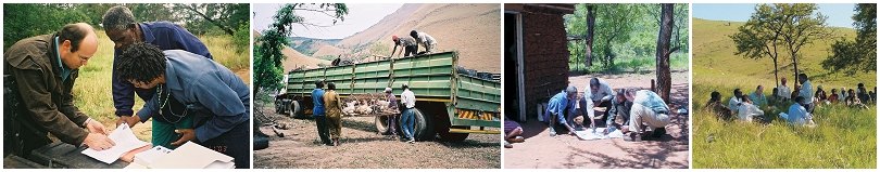
Public awareness of the reserve and its important conservation status is an ongoing task. This is done through field trips, workshops, media releases and coverage of major events and other public relations activities. Initiatives such as the five year bird survey and geological, fauna and flora research contribute greatly to the awareness.


MANAGEMENT
The overall reserve management is done by the Mpumalanga Tourism and Parks Agency (MTPA). Private and community land owners have in effect ceded the conservation management of their land to the MTPA. The MTPA in turn satisfy their conservation mandates through conservation of a larger area which is a very important priority conservation area according to nationally and internationally identified criteria. This also offers significant economies of scale in terms of management costs. Broadly speaking, these management functions include everything from conservation and biological management through to maintaining the game fence, firebreaks and general road upkeep – all the tasks normally associated with management of a reserve.


These management functions are performed through a compliment of dedicated staff appointed for the reserve by the MTPA. The reserve staff is also backed up by a range of other services available within the MTPA from scientific services, game capture and management, anti-poaching units and a regional management structure. Additional labours are contracted from surrounding communities and the reserve’s community partners to address specific needs.
A key task is relations with adjoining communities. Through an ongoing process of engagement the reserve aims to also enhance the benefits received by surrounding communities. This not only includes controlled harvesting of sustainable resources in the reserve and a programme of preferential employment but also training and skills transfer to enable these communities to play an increasingly meaningful role in the future of the reserve.
Each tourism development within the reserve will also have its own staff component which will be dedicated to their respective areas of development. In the case of the Mountainlands Estate, comprising the 18 private lodges in the reserve, this currently consist of an Estate Manager and six staff members. The Estate staff operates in close cooperation with the reserve staff, each within the ambit of their respective responsibilities.
The four founding members of the reserve contribute to the management of the reserve through Mountainlands Executive Committee meetings to direct activities, discuss developmental and other matters of common interest.
INFRASTRUCTURE
Roads
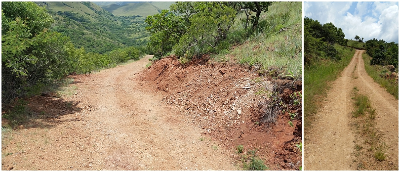
Access to the various development nodes of the reserve and creating a comprehensive network of game viewing roads was a large undertaking in the mountainous terrain. Currently, this road network comprises around 117 km of roads varying from all-weather access roads to the Private and Commercial development sites to game viewing routes. Additionally, there are a further 86 km of 4×4 tracks and old roads on which conditions may vary according to season.
Careful planning and emphasis on creation of circular routes was important to enhance the experience in the reserve. To this will be added additional link roads where required in some areas.
The road construction was done within the framework of the approved Environmental Impact Assessment (EIA) and Environmental Management Plan (EMP) with additional measures undertaken to protect the very unique and unspoiled habitat. The now completed road network consists mainly of old 19th century pioneer roads which first had to be located and surveyed. The network was then designed based on these existing and well rehabilitated roads with the addition of only select access roads and links through a process of upgrading the old roads.
The reserve is directly accessible from tarred national roads on two sides. The R40 and R38 tarred roads offer easy access via the N4 from Johannesburg (three and a half hours) and Pretoria (three hours).
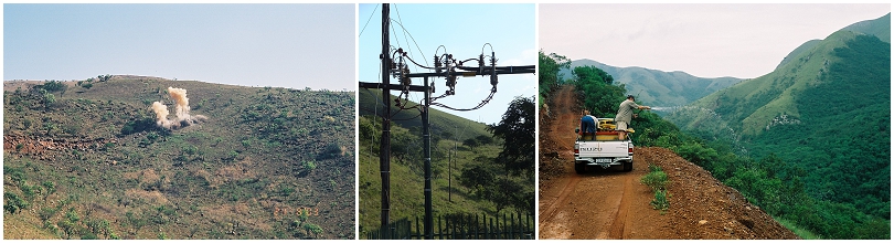
Electricity and water to Mountainlands Estate has been completed and is distributed through an 11km underground network in order to keep the views unspoiled. Water is drawn from two perennial springs. Three phase electricity and potable water is supplied to each stand.
Services as may be required for the commercial developments elsewhere in the reserve will be installed as needed.
SUBSISTENCE FARMERS
At inception of the reserve there were twenty local families resident on the reserve. These households were subsistence farmers who did dry cropping and livestock farming, which was incompatible with the objectives of the reserve. Through an extensive process of negotiation with them and the Department of Land Affairs a series of solutions were developed to suit their individual needs. All the families were classified by the Department of Land Affairs as “labour tenants” as there were no valid land claims submitted on the reserve. One of the primary objectives was to improve the occupier’s tenure and food security by providing, wherever possible, ownership of land to them which could then be passed on to their children, and to ensure that they move to agriculturally productive areas to sustain their livelihoods.
 This resulted in five of the families, who were on private land in the reserve, receiving title to a water rich, 450 hectare farm near Barberton which was purchased for them. They also received building materials, a water reticulation network and agricultural assistance to help them settle on their new farm. Another family from the private land, who owned a large herd of cattle, opted to be moved to tribal land under one of the area’s tribal leaders. A further two families moved out of the reserve onto land belonging to the Lomshiyo Trust who is also a partner in the reserve. The twelve remaining families who are resident on state land have now been included in the planning for a tenure upgrade and agricultural village project north of the reserve.
SUPPORTING PROJECTS
Apart from the ongoing reserve management and game stocking activities, several projects have been undertaken in support of the Mountainlands Nature Reserve and its long-term conservation and development objectives. The following gives a brief overview of some of these projects:
Opening up of historical roads
Many of the roads and hand hewn, stone packed mountain passes were constructed by the explorers of old, some more that more than a 100 years ago. These are mostly well preserved, fully stabilised and naturally rehabilitated through time. They form the basis on which a new road network was built to provide access to different areas of the reserve. More than 117 km of roads have been opened and upgraded. Some old roads and passes are however still discovered from time to time and everything possible is being done to preserve and reuse them. This project is in line with the objectives to minimize impact through the utilization of existing roads and areas previously disturbed.
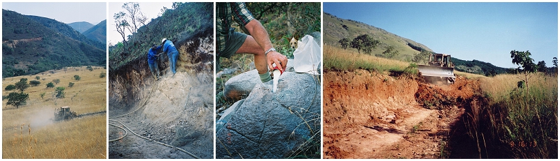
Research into natural, historical and scientific treasures
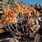
Many of the natural and historical wonders were documented in the last century. With the help of researchers in various fields, some of this information has been collated. However, abundance of knowledge and available data and the task of making this accessible to interpret the significance of the reserve make this a formidable project. This process will also identify additional research projects to be undertaken. Much of the information will be collected from researchers and academics who find the Reserve a continuous source of interest. Research projects: Micro-paleontology; Geology; Archaeology; Botany; Aquatic and Herpetology. Although significant research has been done in these fields, these are ongoing fields of study in need of our support. Much of this work is done through volunteer groups. Two examples are the Barberton Bird Club who is doing a long term survey of the birdlife in the reserve throughout the year, or the Lepidoptera Society who often visit during the butterfly season. The results of this research will be incorporated in future reviews of the management plan of the reserve.
Ecological studies
As part of the conservation management of the reserve a Biological Management Plan and an Environmental Management Plan compiled by experts from the Mpumalanga Tourism and Parks Agency provides direction to management activities. The studies together with those conducted by academics and hobbyists, as described above, contribute significantly to the management plans of the reserve.
Alien vegetation clearing
The reserve has enlisted the assistance of the Department of Water Affairs and Forestry’s “Working for Water” programme and private teams to clear the reserve (mostly the lower lying northern areas) of alien invader species. These were mainly introduced during the previous century’s prospecting activities. As in all protected areas in Southern Africa, the combating of alien vegetation is an ongoing management task.
Removal of man-made structures
Some remnants of old homesteads and turn of the century mining structures are still found in isolated areas of the reserve. These, together with all old fences, cattle pens, groves, orchards and other structures are being eliminated systematically, when encountered.
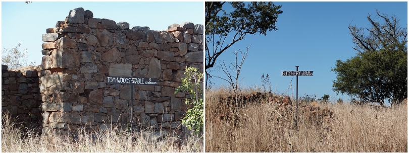
Preservation of Eureka city
This gold rush town is on a mountaintop in the northern portion of the reserve and is a great historical attraction that is under the protection of SAHRA (South African Heritage Resources Agency). This project aims at preserving and developing the historical value of the old town and its diggings (including the Edwin Bray or Golden Quarry diggings). It is also the location of one of the identified commercial lodge developments, possibly with a historical, mining or colonial theme.
Development of a commercial lodge at Lomshiyo
The local Lomshiyo tribe has contributed a large tract of land to the reserve on the far eastern side. They are also a founding member of the Mountainlands Nature Reserve. Their land is suitable for the development of a concession based small to medium sized commercial game lodge. The reserve owners are rallying behind the trust in assisting them with planning and business skills to bring their development to fruition.
COMMERCIAL INVESTMENT OPPORTUNITIES
Read more about the commercial investment opportunities in Mountainlands Reserve …